Overview
For nearly 100 years, our community has relied on this long-standing connection. While the Burnside Bridge and other downtown Portland bridges are historic landmarks in our community, right now, none of downtown Portland’s Willamette River vehicular bridges will be immediately usable after a major earthquake. Multnomah County is leading an effort to replace the current Burnside Bridge with one that can withstand a Cascadia Subduction Zone earthquake. It’s one of the largest earthquake resilience projects in Oregon.
As the project is now in the Design Phase, the community’s voice will play an important role in the future look of the new bridge.
What will the future Burnside Bridge look like?
The County is asking for community input on design concepts for the east span of the new Burnside Bridge. This online open house is designed to give an overview of the project and the range of the design concepts being considered.
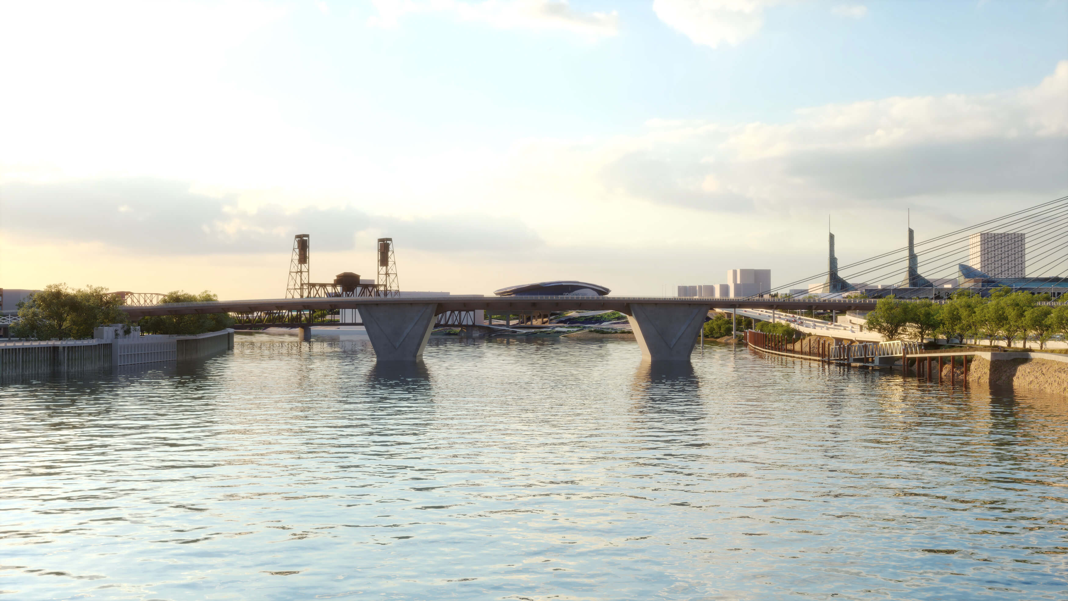
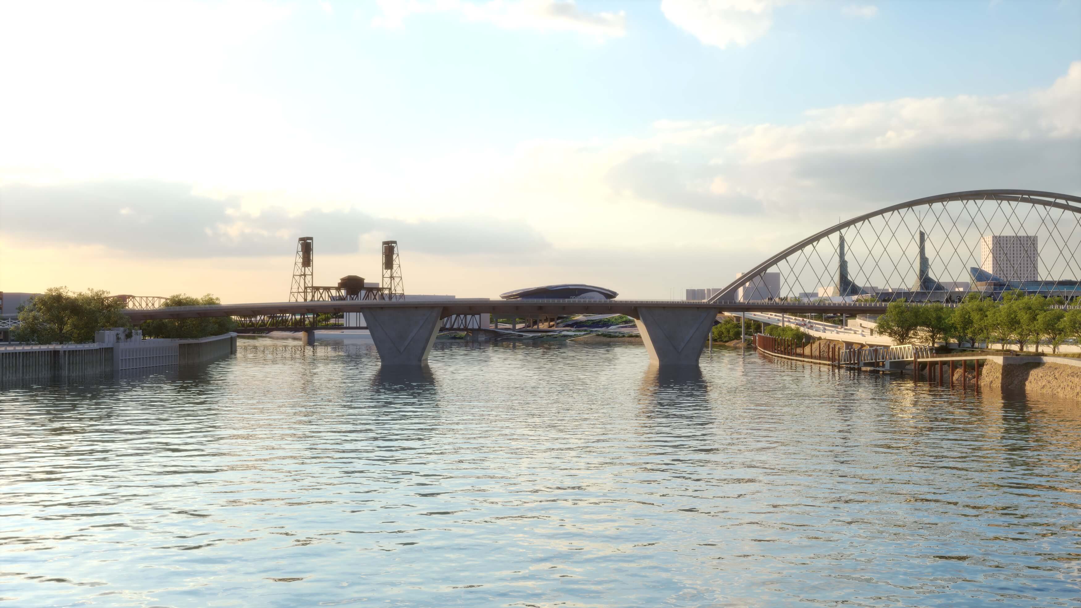
The general form of the bridge was determined during the project’s Environmental Review Phase and included a ‘girder’ design (similar to the existing Burnside Bridge) on the west approach, a bascule design (similar to the existing Burnside Bridge) for the movable span over the river channel and a long span design for the east approach. While the west approach and movable spans are established, the County is considering two general bridge types for the east approach. This online open house will give you an overview of the two bridge types and share multiple variations for you to consider.
All design concepts presented have similar cost, risk and constructability tradeoffs.
Additional Information: Pop over to this page to learn more about the project and how we got here!
Bridge Design Concepts
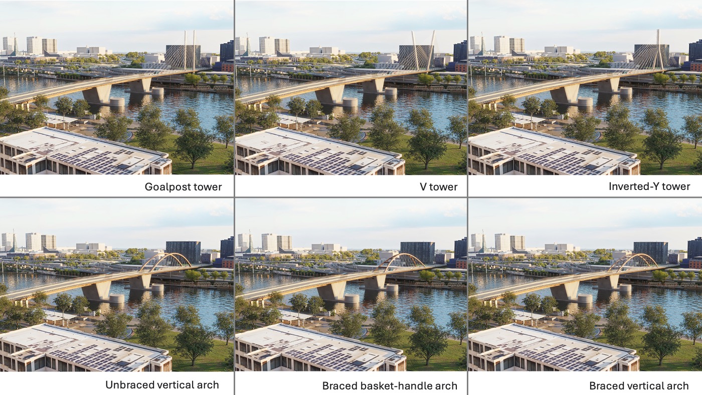
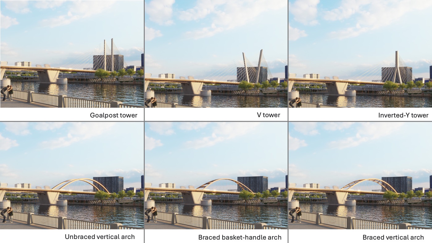
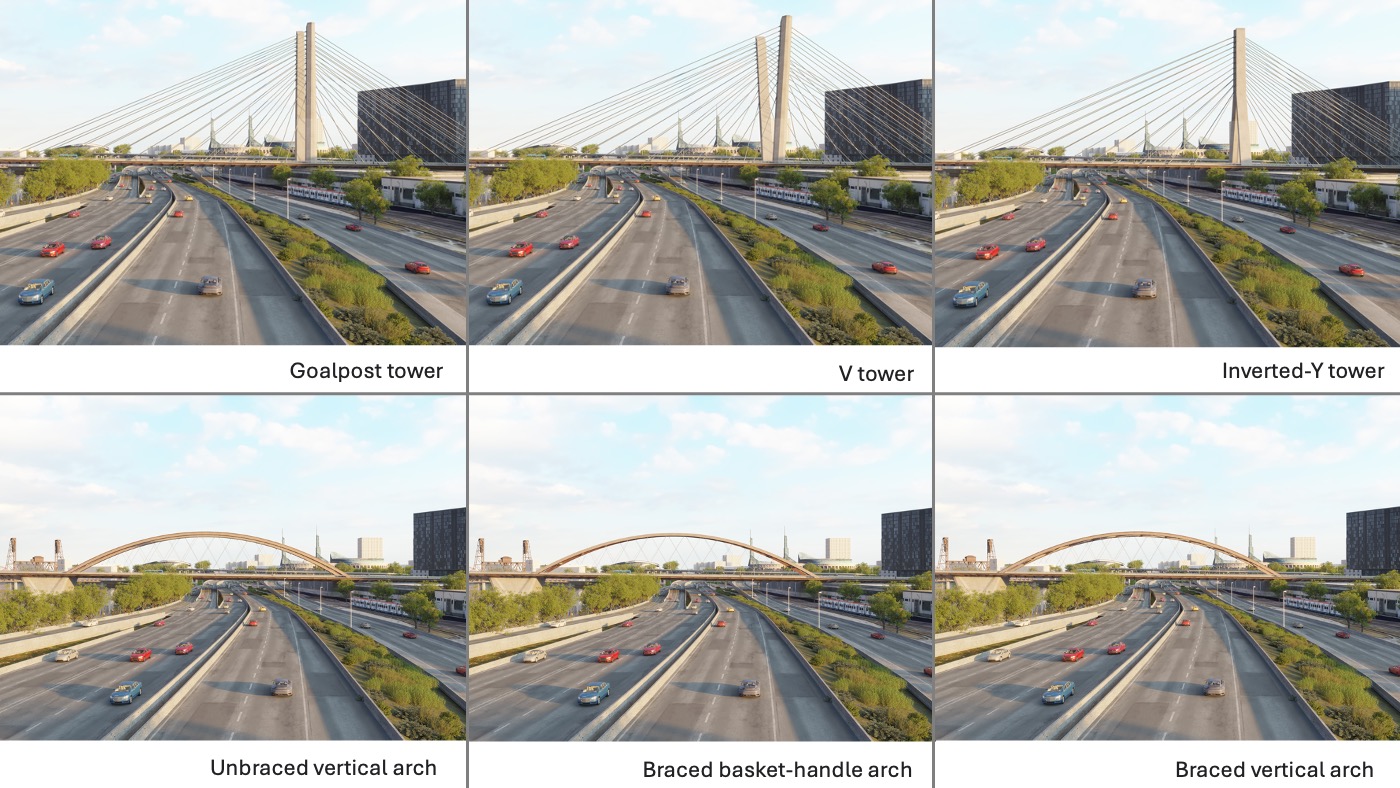
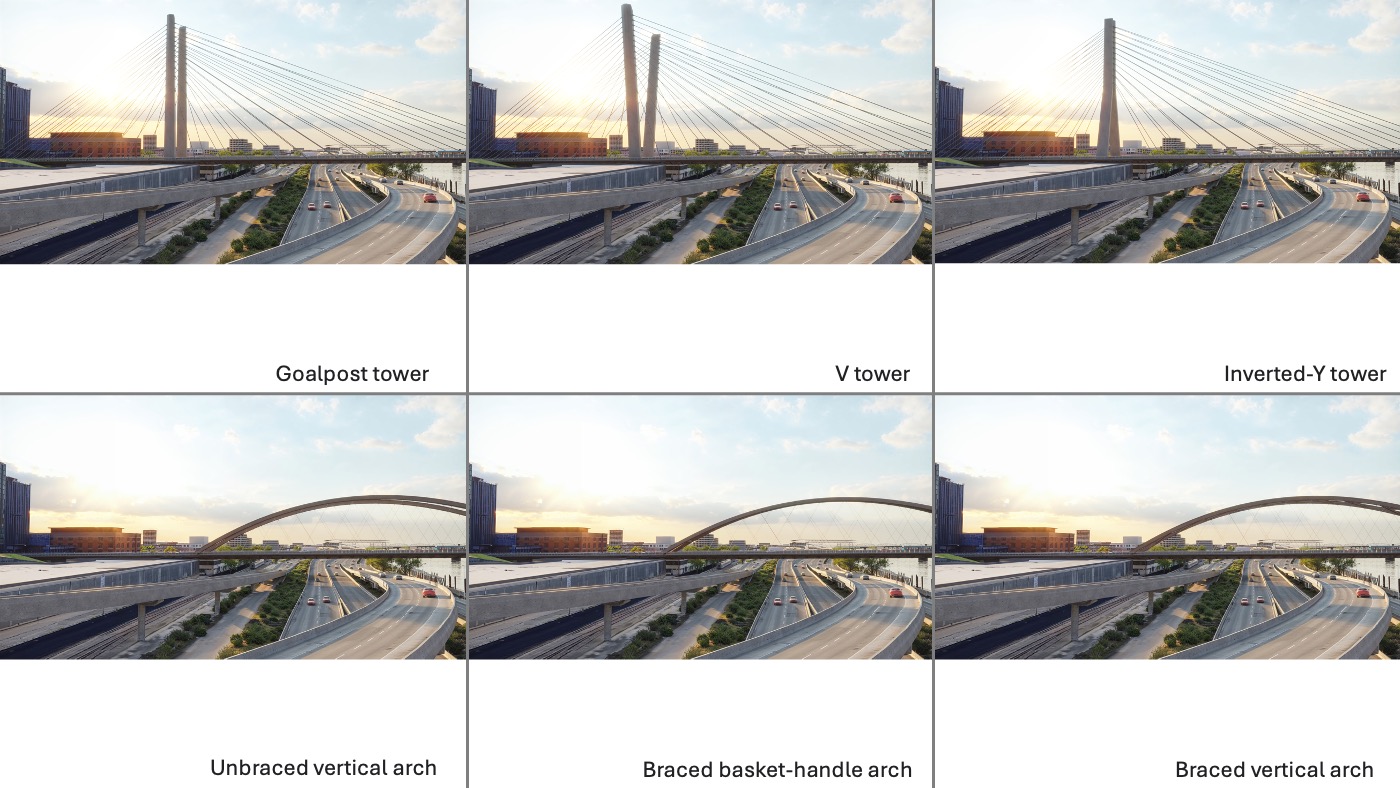
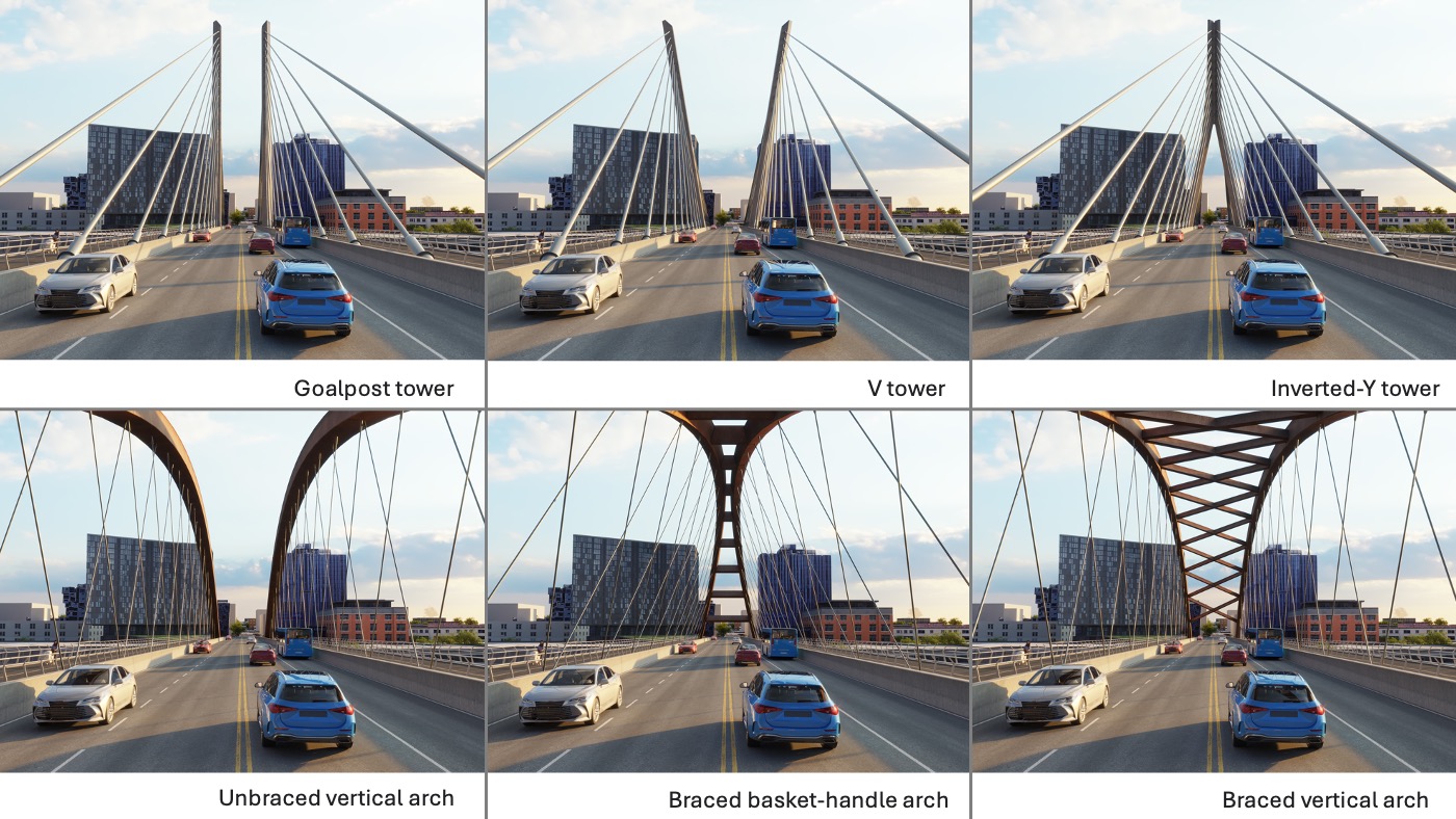
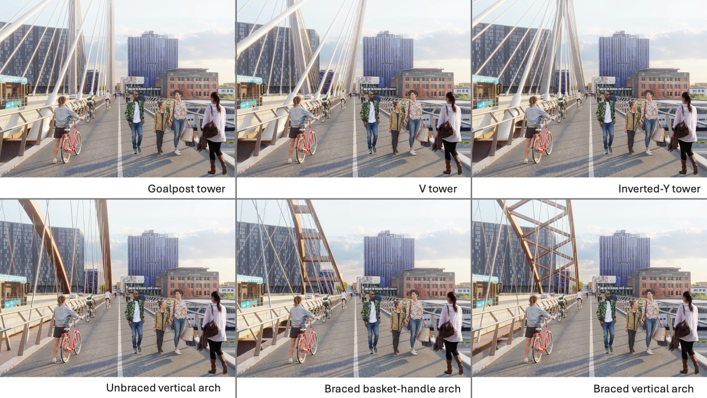
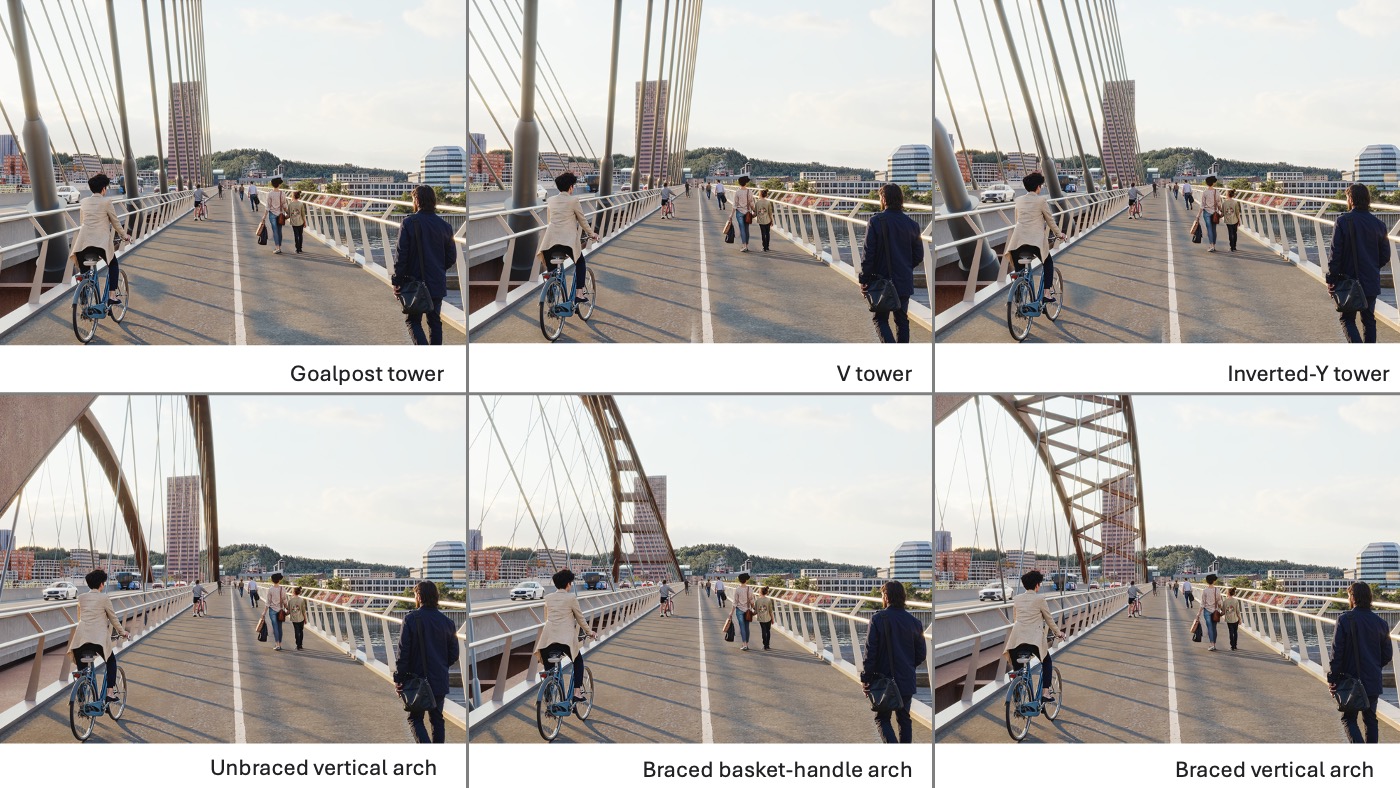
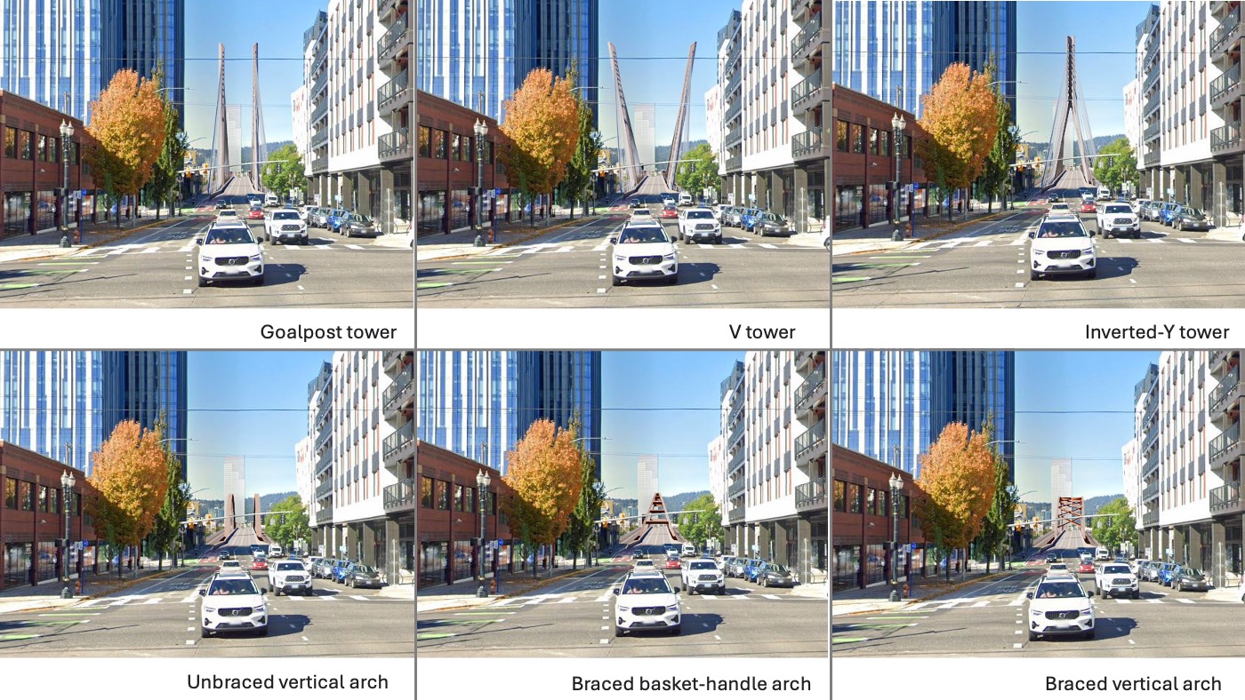
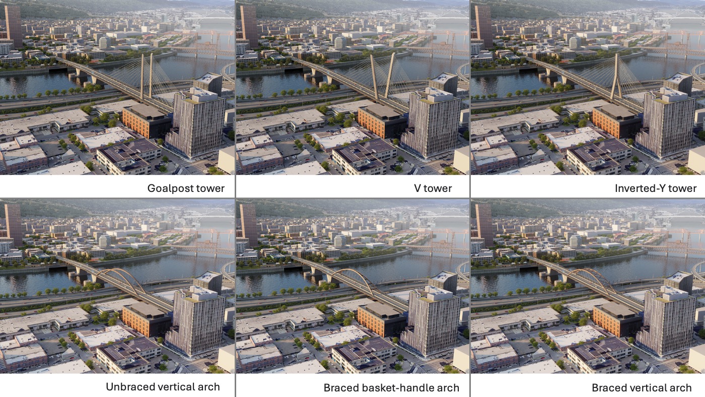
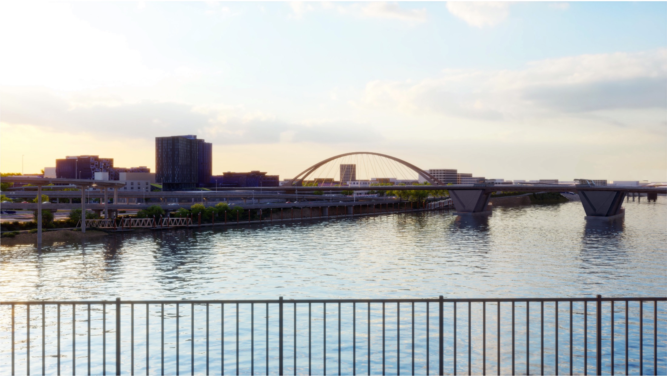
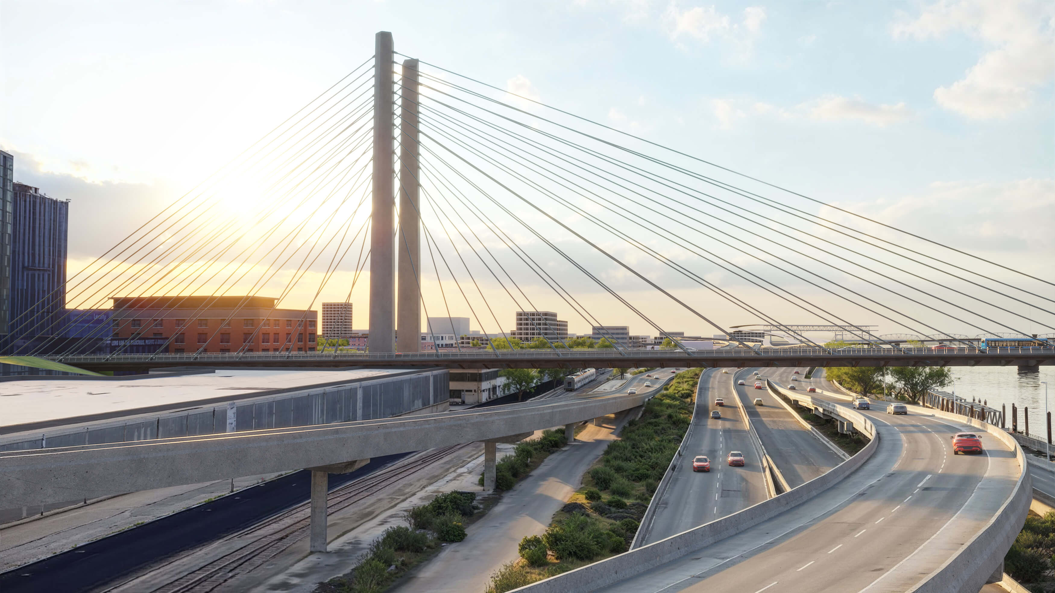
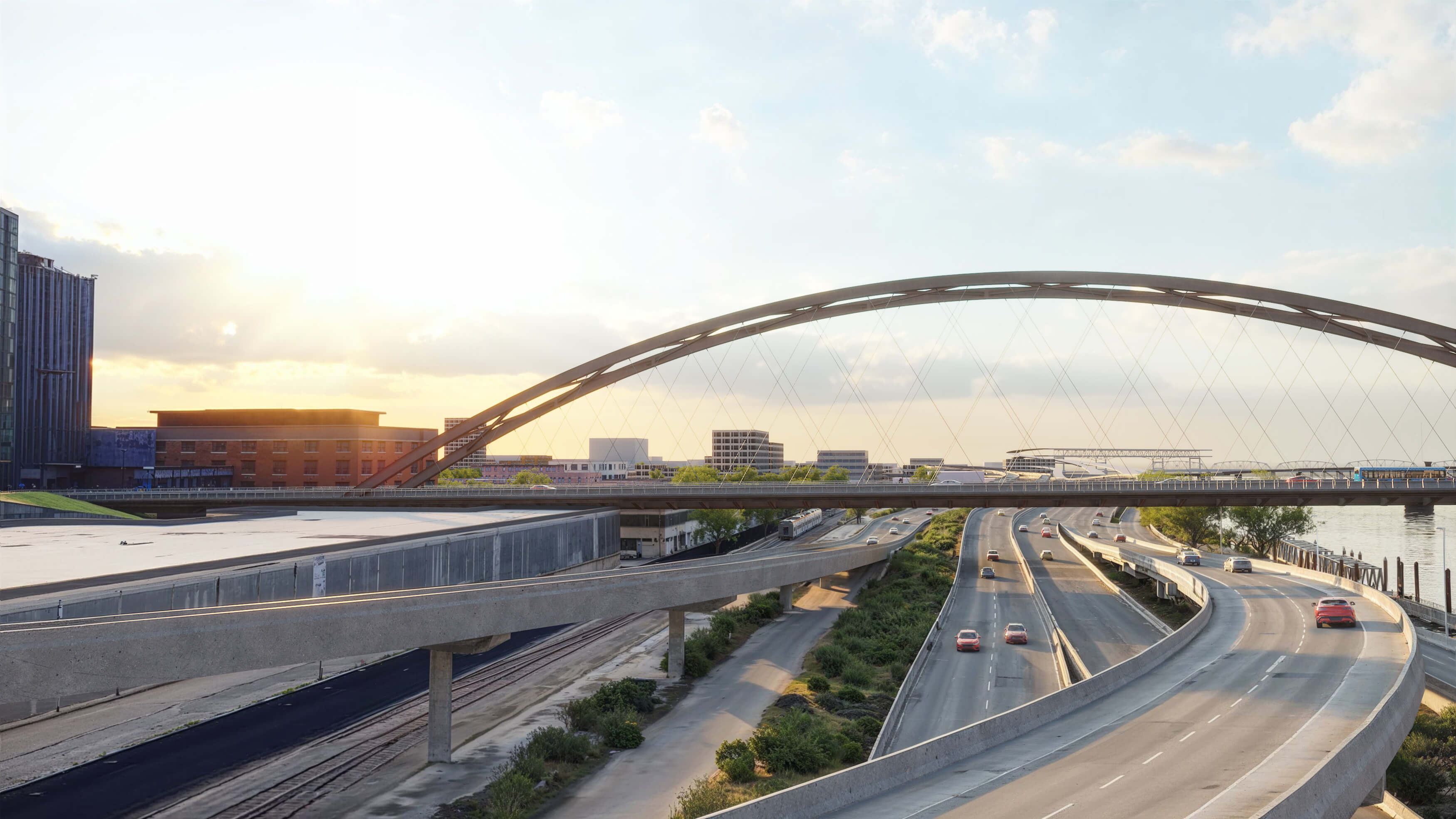
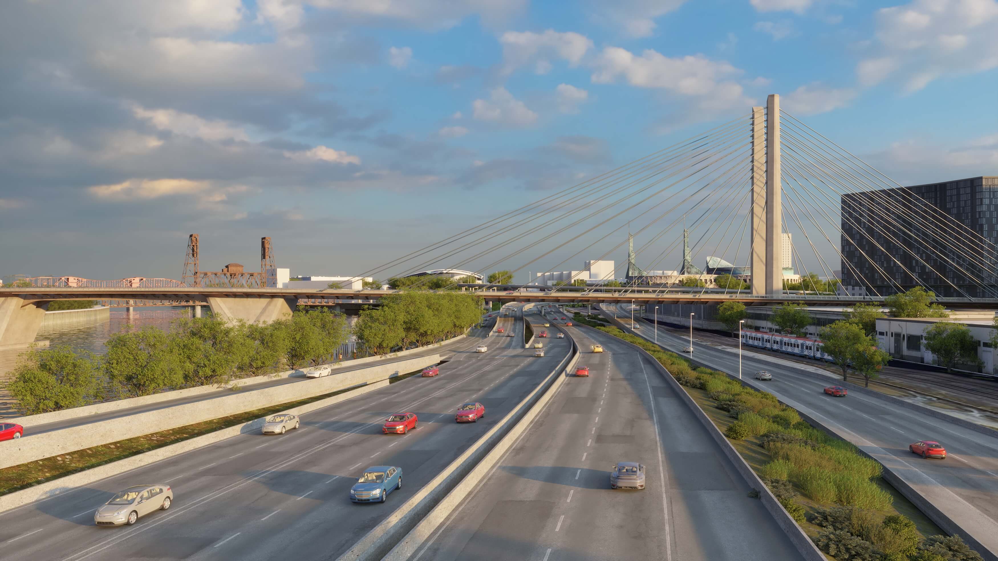
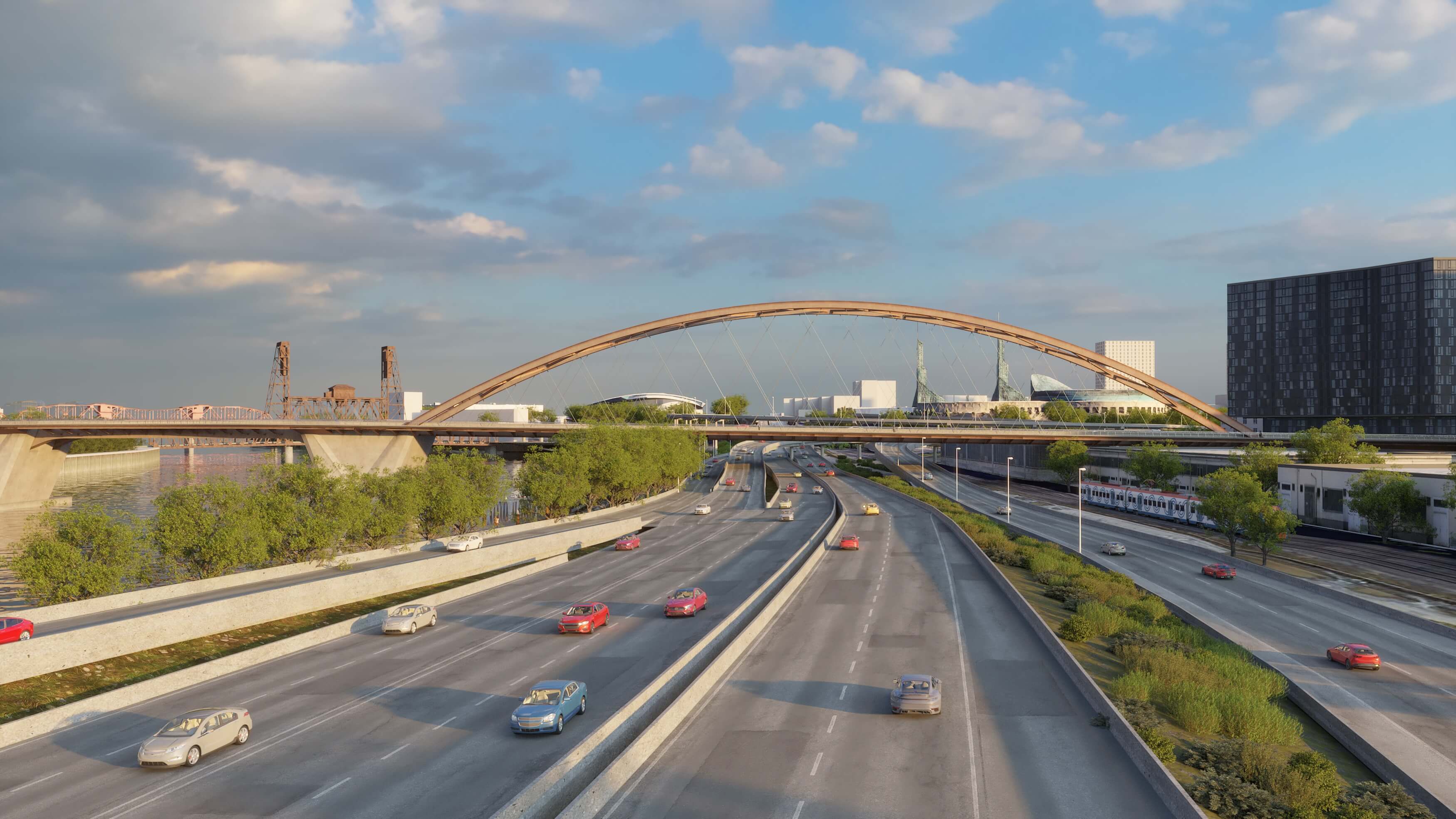
The two east span bridge types under consideration are the cable stay (similar to the Tilikum Crossing) and the tied arch (similar to the Wapato Bridge that connects to Sauvie Island). These two bridge types vary in height, character, materials, views and other characteristics. Below are some key attributes to consider when reviewing the options. Click on each bridge type to learn more about the different sub options.
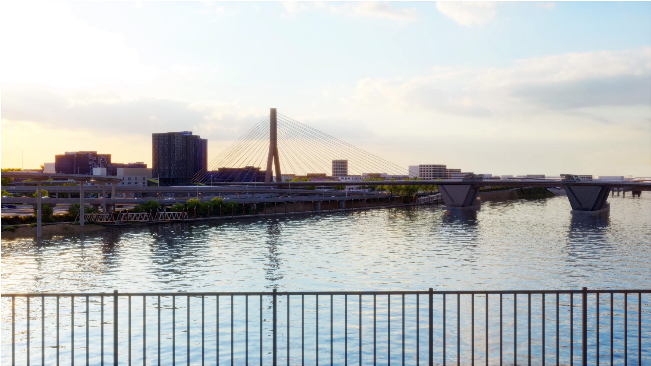
Cable Stay Type
Tied Arch Type
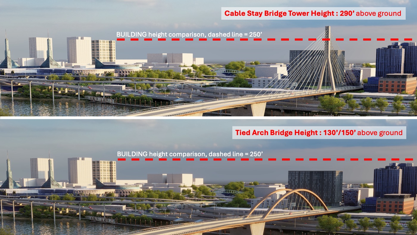
Comparison of Bridge Height
Below you'll see height, materials and sightline comparisons between the two bridge types.
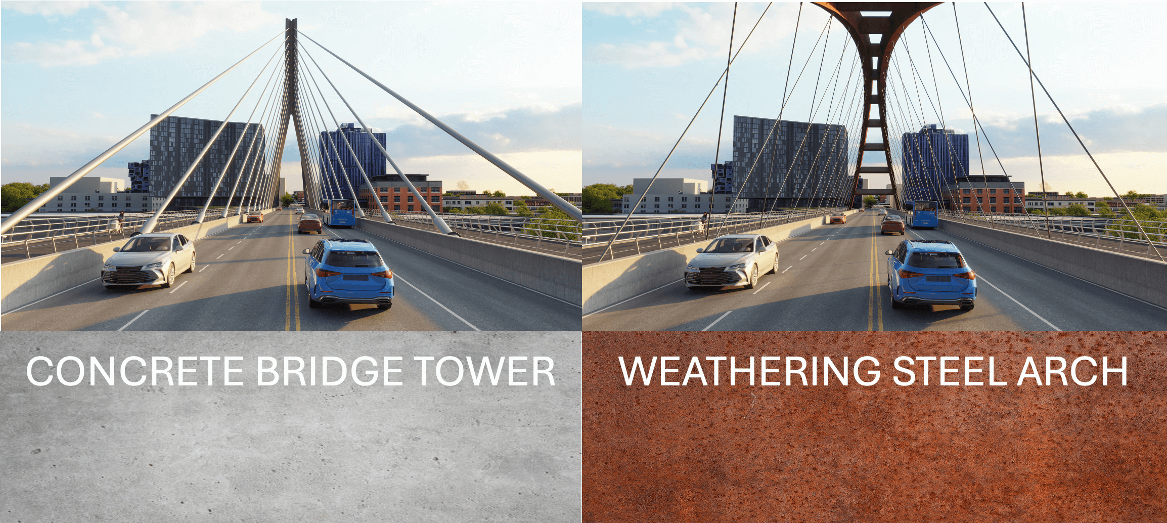
Comparison of Bridge Materials
Comparison of Sightlines
Use the green circle arrow to toggle back and forth between the different sightlines for each bridge type.
Comparison Views of Bridge Types
Below you'll see the six bridge type options that are being considered. There are three cable stay and three tied arch options.